Property Record
2100 Airways Blvd, Memphis, TN 38114

NEARBY LISTINGS FOR SALE OR LEASE
Property Detail
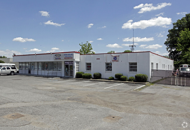
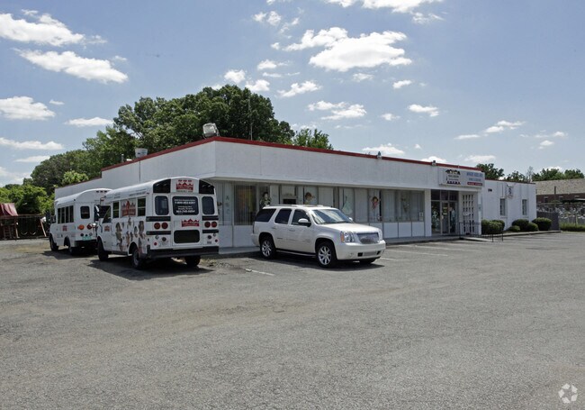
2100 Airways Blvd
06-0121-0-0052
Abernathy Industrial
Daycare
Shelby
X
Tennessee
47157C0430F
3
2024
0.86 AC
2025
Downtown/Midtown
006900
Memphis
8,000 SF
Memphis, TN-MS-AR
DEMOGRAPHICS near 2100 Airways Blvd
1 Mile
3 Mile
5 Mile
2024 Total Population
9,273
75,600
223,303
2029 Population
9,503
76,572
224,456
Pop Growth 2024-2029
+ 2.48%
+ 1.29%
+ 0.52%
Average Age
36
38
38
2024 Total Households
3,652
31,241
94,320
HH Growth 2024-2029
+ 2.38%
+ 1.11%
+ 0.40%
Median Household Inc
$21,403
$35,123
$38,317
Avg Household Size
2.40
2.30
2.30
2024 Avg HH Vehicles
1.00
1.00
1.00
Median Home Value
$54,221
$82,715
$130,166
Median Year Built
1955
1955
1958
Nearby Places
Map Layers
Map Styles
 Street
 Aerial
- Restaurants
- Banks
- Shops
- Fitness
- Groceries
PUBLIC TRANSPORTATION
COMMUTER RAIL
Central Station (Riverfront Loop - Memphis Area Transit Authority Trolley (MataTrolley))
DRIVE
WALK
Distance
Central Station (Riverfront Loop - Memphis Area Transit Authority Trolley (MataTrolley))
11 min
6.6 mi
AIRPORT
Memphis International
DRIVE
WALK
Distance
Memphis International
10 min
3.8 mi
Nearby Properties
Address
Land Use
TOTAL SIZE
Lot Size
Zoning
Address
Land Use
TOTAL SIZE
Lot Size
Zoning
386,565 SF
29.49 AC
IH
Address
Land Use
TOTAL SIZE
Lot Size
Zoning
105,841 SF
7.45 AC
IH
Address
Land Use
TOTAL SIZE
Lot Size
Zoning
38,600 SF
30.35 AC
RU-3
Address
Land Use
TOTAL SIZE
Lot Size
Zoning
2,847.82 AC
EMP
Address
Land Use
TOTAL SIZE
Lot Size
Zoning
345,806 SF
33.16 AC
RU-3
Address
Land Use
TOTAL SIZE
Lot Size
Zoning
47.65 AC
R-8
Address
Land Use
TOTAL SIZE
Lot Size
Zoning
1,760,826 SF
109.47 AC
EMP
Address
Land Use
TOTAL SIZE
Lot Size
Zoning
81,454 SF
EMP
Address
Land Use
TOTAL SIZE
Lot Size
Zoning
69,204 SF
4.54 AC
CMU-3
Address
Land Use
TOTAL SIZE
Lot Size
Zoning
342,605 SF
82.99 AC
CA
Address
Land Use
TOTAL SIZE
Lot Size
Zoning
1,117,337 SF
127.15 AC
EMP
Address
Land Use
TOTAL SIZE
Lot Size
Zoning
55,250 SF
7.15 AC
CMU-3
Address
Land Use
TOTAL SIZE
Lot Size
Zoning
300,011 SF
17.53 AC
EMP
Address
Land Use
TOTAL SIZE
Lot Size
Zoning
71,308 SF
EMP
Address
Land Use
TOTAL SIZE
Lot Size
Zoning
66,841 SF
7.86 AC
CMU-3
Address
Land Use
TOTAL SIZE
Lot Size
Zoning
62,022 SF
6.28 AC
EMP
Address
Land Use
TOTAL SIZE
Lot Size
Zoning
42,102 SF
18.74 AC
RU-3
Address
Land Use
TOTAL SIZE
Lot Size
Zoning
209,257 SF
39.71 AC
EMP
Address
Land Use
TOTAL SIZE
Lot Size
Zoning
7,632 SF
40.80 AC
EMP
Address
Land Use
TOTAL SIZE
Lot Size
Zoning
203,086 SF
6.32 AC
IH
Address
Land Use
TOTAL SIZE
Lot Size
Zoning
367,132 SF
18.54 AC
EMP
Address
Land Use
TOTAL SIZE
Lot Size
Zoning
56,848 SF
1.61 AC
EMP
Address
Land Use
TOTAL SIZE
Lot Size
Zoning
28,298 SF
1.73 AC
CMU-1
Address
Land Use
TOTAL SIZE
Lot Size
Zoning
41,868 SF
3.21 AC
EMP
Address
Land Use
TOTAL SIZE
Lot Size
Zoning
29,712 SF
1.92 AC
EMP
Address
Land Use
TOTAL SIZE
Lot Size
Zoning
200,920 SF
EMP
Address
Land Use
TOTAL SIZE
Lot Size
Zoning
545,525 SF
31.04 AC
EMP
Address
Land Use
TOTAL SIZE
Lot Size
Zoning
108,970 SF
11.40 AC
RU-1
Address
Land Use
TOTAL SIZE
Lot Size
Zoning
208,796 SF
12.13 AC
EMP
Address
Land Use
TOTAL SIZE
Lot Size
Zoning
536,821 SF
32.62 AC
EMP
The World's #1 Commercial Real Estate Marketplace
Connect with us
© 2026 CoStar Group
The information above has been obtained from sources believed reliable. While we do not doubt its accuracy we have not verified it and make no guarantee, warranty or representation about it. It is your responsibility to independently confirm its accuracy and completeness. Any projections, opinions, assumptions, or estimates used are for example only and do not represent the current or future performance of the property. The value of this transaction to you depends on tax and other factors which should be evaluated by your tax, financial, and legal advisors. You and your advisors should conduct a careful, independent investigation of the property to determine to your satisfaction the suitability of the property for your needs.